Central Tasmania
from:
'Picturesque Atlas of Historical Australia' {Link}Central Highlands of Tasmania
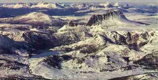
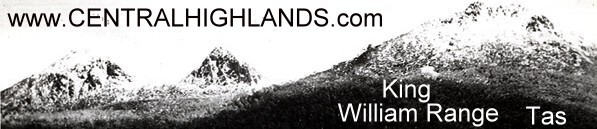
WITHIN the circumference of a radial line of fifty or sixty miles, drawn from King William the Third Mountain to all points of the compass, are comprised a labyrinth of ranges, the whole of the lakes, the great plains, the sources of the most important rivers, including the Derwent, the Murray, and the Gordon, and with a single exception, every mountain which reaches an altitude of four thousand seven hundred feet and upwards. Most of the ranges run from north to south, and vary from ten to fifteen miles in length. In one instance that of the mountain system whose domes or pinnacles bear the honoured names of Tyndall, Sedgwick, Lyell, Owen, Huxley, Jukes, and Darwin —the distance from the most northerly to the most southerly peak is upwards of five and twenty miles; the continuity of the chain being broken only by three narrow gaps. A longitudinal line one hundred miles in length, and bisecting the King William Range half-way from its starting point, would pretty accurately define the boundary of the mountainous country to the west, and of the lake region to the east. Extensive plains predominate in the latter, with here and there an isolated hill upon which, in four separate instances, the discoverer has bestowed the name of Sugar-loaf, with the addition of his own. But on the other side of this imaginary line the counties of Montague, Franklin, and Montgomery, are thickly embossed with ranges, while all the intervening valleys, whether broadening out into extensive flats or narrowing into deep ravines, are watered by streams or creeks, most of which pour their waters into the Gordon, a river taking its rise in Lake Richmond and emptying itself into one of the southern arms of Macquarie Harbour.King William Range, however, with its triple crests absurdly enough named after as many English monarchs, divides two watersheds, and some of the sources of the Derwent come from its eastern slopes. So also do the main springs of the Gordon, which runs parallel with the Derwent for thirty miles or so, and then after passing through the appropriately designated Valley of Rasselas, makes a sharp angle at the Great Bend near the small settlement of Huntly, and pursues its course to the westward. The loftiest of the three peaks which have just been referred to, is four thousand three hundred and sixty feet high, or nearly two hundred feet higher than Mount Wellington, to which its fluted escarpments cause it to bear a certain resemblance. Its massive buttresses are clothed with forests which are literally pathless and perfectly impenetrable on the higher levels; for the vapour-laden atmosphere, chilled and condensed by contact with the lower temperature of the lofty trees, precipitates itself in misty rain or heavy shower, and the perennial moisture maintains a luxuriant undergrowth of tangled shrubs and creepers. On both sides of its broad base, the streams which have their birth among its unexplored recesses relieve the sombre grandeur of the landscape by interposing bright reflections of argent cloud and azure sky, while the rugged features of the mountain itself are softened when repeated in the waters of a still lagoon, with nothing to break the smoothness of its glassy surface but the stately movements of an occasional pair of black swans so unaccustomed to the intrusion of a human being in their solitudes as to regard him with more of curiosity than apprehension.